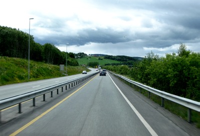
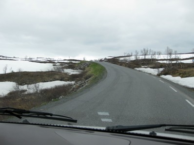
Trick question: which of the pictures below is of a Norwegian “E” highway, i.e., the highest designation, one of the roads than which there is no better?
This?

Or this?

Answer: both of them.
The first one was taken a bit north of Trondheim, where the countryside is more densely populated; the second is of the road much farther north, where the promise of less traffic seems to have given the civil engineers license to let nature dictate not only the road’s direction but also its width, severity of ascent and descent, camber. . . .
For the first 240 miles north of Trondheim, the E6 is pretty easy driving: there’s a yellow line down the center, pull-over places, and quite a few small rest areas. Driveways and streets enter directly on the road, and there’s restricted access only in bigger towns (where one might actually want to access a gas station or grocery). There are narrow places and a few single-lane bridges, but generally, thanks to the spectacular scenery, it is a beautiful drive--at least for the passenger.
We followed along the Trondheimfjord and then through farm country that looked like Germany’s Black Forest. But the road goes mostly through pine forests and along lakes, rushing rivers and streams--RIGHT along the very edge of rushing rivers and streams--through a few tunnels, winding up and down a whole lot of big, big hills. We passed many motorhomes going south and often we went for miles without seeing anyone, feeling very remote.
We camped overnight in Mosjoen (pronounced sort of like “motion”) at a campground that boasted the first bowling alley we’ve seen in Norway. The next morning we continue our trek north toward our goal . . . the Arctic Circle. Ominously, the road begins to deteriorate: the yellow center line disappears, the severity of the winding and climbing and falling increase, the road is trafficked mostly by motorhomes and 18-wheelers. Sometimes there are guardrails, but mostly not. The only shoulders are on newly paved sections, which generally don’t amount to more than a mile or so. There is just barely room to pass at 40 mph. Then the pièce de résistance: work on a tunnel sends us on a 9-mile detour up and down a mountain. We pass a woman pushing her bike up the 9% grade.
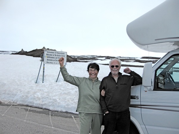
At the Arctic Circle there is a tourist store, a marker, and a parking lot full of motorhomes. One had an Australian license plate, and we saw someone taking a picture of ours. The “Polarsirkelsenteret” is above the tree line and, appropriately, there was still snow on the ground. The temperature was in the low 50s so the snow was melting fast, filling the waterfalls and streams we had seen along the way. We took the necessary pictures,

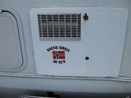
walked around the shop, bought the obligatory t-shirt and bumper sticker, had lunch . . . and then headed Rover back south, this time knowing exactly what kind of road we faced.
It was a beautiful drive through a bazillion spruce trees and birches, and we are glad we did it. True, with Rover getting 10 mpg and gas at $9/gallon, it was a pretty expensive side trip. But we can say, “We made it to the Arctic Circle!”
And so can Rover.

